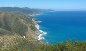
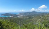
![](/images/other/stat-length.png)
![Tocht Te voet Sestri Levante - Riva Trigoso - Punta Baffe - Monte Moneglia - Photo](https://media.geolcdn.com/t/1900/400/1115744a-0a88-4869-a7bf-faa659b5b34a.jpeg&format=pjpeg&maxdim=2)
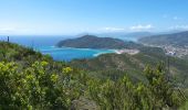
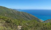
Riva Trigoso - Punta Baffe - Monte Moneglia
SityTrail - itinéraires balisés pédestres
Tous les sentiers balisés d’Europe GUIDE+
![Lengte](/images/other/stat-length.png)
Lengte
5 km
![Max. hoogte](https://static1.geolcdn.com/siteimages/upload/files/1508320355ic_sort_altitude_max_24dp.png)
Max. hoogte
512 m
![Positief hoogteverschil](https://static1.geolcdn.com/siteimages/upload/files/1508320355ic_sort_den_pos_24dp.png)
Positief hoogteverschil
525 m
![Km-Effort](/images/other/stat-length.png)
Km-Effort
10,4 km
![Min. hoogte](https://static1.geolcdn.com/siteimages/upload/files/1508320355ic_sort_altitude_min_24dp.png)
Min. hoogte
20 m
![Negatief hoogteverschil](https://static1.geolcdn.com/siteimages/upload/files/1508320355ic_sort_den_neg_24dp.png)
Negatief hoogteverschil
36 m
![Boucle](https://static1.geolcdn.com/siteimages/upload/files/16400158638029165_repeat_loop_refresh_sync_direction_icon.png)
Boucle
Neen
Markering
Datum van aanmaak :
2022-02-14 22:25:28.142
Laatste wijziging :
2022-02-28 15:53:21.367
![Te voet](https://static1.geolcdn.com/sitytour/trail-icons/100.png)
2h22
Moeilijkheid : Gemakkelijk
![Scan deze QR-code om de tocht te openen in de SityTrail-applicatie](https://capi.geolives.com/qq0zvz2zws4bq2lad0pu/sitytour/trails/3112034/qr.png?size=200)
Gratisgps-wandelapplicatie
Over ons
Tocht Te voet van 5 km beschikbaar op Ligurië, Genua, Sestri Levante. Deze tocht wordt voorgesteld door SityTrail - itinéraires balisés pédestres.
Beschrijving
Symbol: 2 red circles
Plaatsbepaling
Land:
Italy
Regio :
Ligurië
Departement/Provincie :
Genua
Gemeente :
Sestri Levante
Locatie:
Unknown
Vertrek:(Dec)
Vertrek:(UTM)
534459 ; 4900898 (32T) N.
Opmerkingen
Wandeltochten in de omgeving
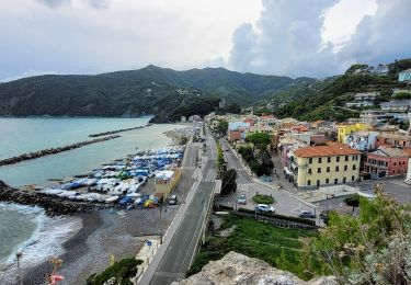
![Tocht Te voet Moneglia - sejour-cinq-terres-journee-1-decouverte-de-moneglia - Photo](https://media.geolcdn.com/t/375/260/db45af9a-684d-45c3-b432-53fd5a1e410f.jpg&format=jpg&maxdim=2)
![Te voet Te voet](https://static1.geolcdn.com/sitytour/trail-icons/100.png)
sejour-cinq-terres-journee-1-decouverte-de-moneglia
Te voet
Gemakkelijk
Moneglia,
Ligurië,
Genua,
Italy
![](/images/other/stat-length.png)
4,1 km | 4,9 km-effort
1h 6min
![](https://static1.geolcdn.com/siteimages/upload/files/16400158638029165_repeat_loop_refresh_sync_direction_icon.png)
Ja
![Tocht Te voet Sestri Levante - Sestri Levante - San Bernardo - Monte Capenardo - Photo](https://media.geolcdn.com/t/375/260/1687113b-52ed-4582-a926-9157025824b6.jpeg&format=jpg&maxdim=2)
![Te voet Te voet](https://static1.geolcdn.com/sitytour/trail-icons/100.png)
Sestri Levante - San Bernardo - Monte Capenardo
Te voet
Gemakkelijk
Sestri Levante,
Ligurië,
Genua,
Italy
![](/images/other/stat-length.png)
5,4 km | 12,2 km-effort
2h 46min
![](https://static1.geolcdn.com/siteimages/upload/files/16400158638029165_repeat_loop_refresh_sync_direction_icon.png)
Neen
![Tocht Te voet Sestri Levante - IT-404 - Photo](https://media.geolcdn.com/t/375/260/5eb823c6-2209-446a-ab07-0ba54484b9f0.jpeg&format=jpg&maxdim=2)
![Te voet Te voet](https://static1.geolcdn.com/sitytour/trail-icons/100.png)
IT-404
Te voet
Gemakkelijk
Sestri Levante,
Ligurië,
Genua,
Italy
![](/images/other/stat-length.png)
9,3 km | 18,7 km-effort
4h 14min
![](https://static1.geolcdn.com/siteimages/upload/files/16400158638029165_repeat_loop_refresh_sync_direction_icon.png)
Neen
![Tocht Te voet Sestri Levante - IT-412 - Photo](https://media.geolcdn.com/t/375/260/fcb529d0-12b5-4dbc-9657-8830ba99fa2e.jpeg&format=jpg&maxdim=2)
![Te voet Te voet](https://static1.geolcdn.com/sitytour/trail-icons/100.png)
IT-412
Te voet
Gemakkelijk
Sestri Levante,
Ligurië,
Genua,
Italy
![](/images/other/stat-length.png)
4,4 km | 8,1 km-effort
1h 50min
![](https://static1.geolcdn.com/siteimages/upload/files/16400158638029165_repeat_loop_refresh_sync_direction_icon.png)
Neen
![Tocht Te voet Sestri Levante - Sestri Levante - Monte Costello - Photo](https://media.geolcdn.com/t/375/260/fa1cb816-2a06-4c87-9850-ba239f820577.jpeg&format=jpg&maxdim=2)
![Te voet Te voet](https://static1.geolcdn.com/sitytour/trail-icons/100.png)
Sestri Levante - Monte Costello
Te voet
Gemakkelijk
Sestri Levante,
Ligurië,
Genua,
Italy
![](/images/other/stat-length.png)
3,9 km | 8,8 km-effort
2h 0min
![](https://static1.geolcdn.com/siteimages/upload/files/16400158638029165_repeat_loop_refresh_sync_direction_icon.png)
Neen
![Tocht Te voet Casarza Ligure - Casarza Ligure - Bargone - Passo del Bocco di Bargone - Photo](https://media.geolcdn.com/t/375/260/8251746c-e21b-4220-a131-bad7db5c6a0b.jpeg&format=jpg&maxdim=2)
![Te voet Te voet](https://static1.geolcdn.com/sitytour/trail-icons/100.png)
Casarza Ligure - Bargone - Passo del Bocco di Bargone
Te voet
Gemakkelijk
Casarza Ligure,
Ligurië,
Genua,
Italy
![](/images/other/stat-length.png)
4,6 km | 8,4 km-effort
1h 53min
![](https://static1.geolcdn.com/siteimages/upload/files/16400158638029165_repeat_loop_refresh_sync_direction_icon.png)
Neen
![Tocht Te voet Casarza Ligure - Casarza Ligure - Bivio di Ca' Bianca - Photo](https://media.geolcdn.com/t/375/260/1c09bed0-411f-4900-8221-e7faed97623d.jpeg&format=jpg&maxdim=2)
![Te voet Te voet](https://static1.geolcdn.com/sitytour/trail-icons/100.png)
Casarza Ligure - Bivio di Ca' Bianca
Te voet
Gemakkelijk
Casarza Ligure,
Ligurië,
Genua,
Italy
![](/images/other/stat-length.png)
5,3 km | 10,8 km-effort
2h 27min
![](https://static1.geolcdn.com/siteimages/upload/files/16400158638029165_repeat_loop_refresh_sync_direction_icon.png)
Neen
![Tocht Te voet Casarza Ligure - Casarza Ligure - Colle di Casa Venino - Photo](https://media.geolcdn.com/t/375/260/484050a9-5226-48f8-8cd5-63764d563f30.jpeg&format=jpg&maxdim=2)
![Te voet Te voet](https://static1.geolcdn.com/sitytour/trail-icons/100.png)
Casarza Ligure - Colle di Casa Venino
Te voet
Gemakkelijk
Casarza Ligure,
Ligurië,
Genua,
Italy
![](/images/other/stat-length.png)
6,1 km | 11 km-effort
2h 30min
![](https://static1.geolcdn.com/siteimages/upload/files/16400158638029165_repeat_loop_refresh_sync_direction_icon.png)
Neen
![Tocht Te voet Sestri Levante - Moneglia-Punta Baffe - Photo](https://media.geolcdn.com/t/375/260/d943f70a-3769-47de-adba-9db1a48ba1cf.jpeg&format=jpg&maxdim=2)
![Te voet Te voet](https://static1.geolcdn.com/sitytour/trail-icons/100.png)
Moneglia-Punta Baffe
Te voet
Gemakkelijk
Sestri Levante,
Ligurië,
Genua,
Italy
![](/images/other/stat-length.png)
6,2 km | 10,8 km-effort
2h 27min
![](https://static1.geolcdn.com/siteimages/upload/files/16400158638029165_repeat_loop_refresh_sync_direction_icon.png)
Neen